



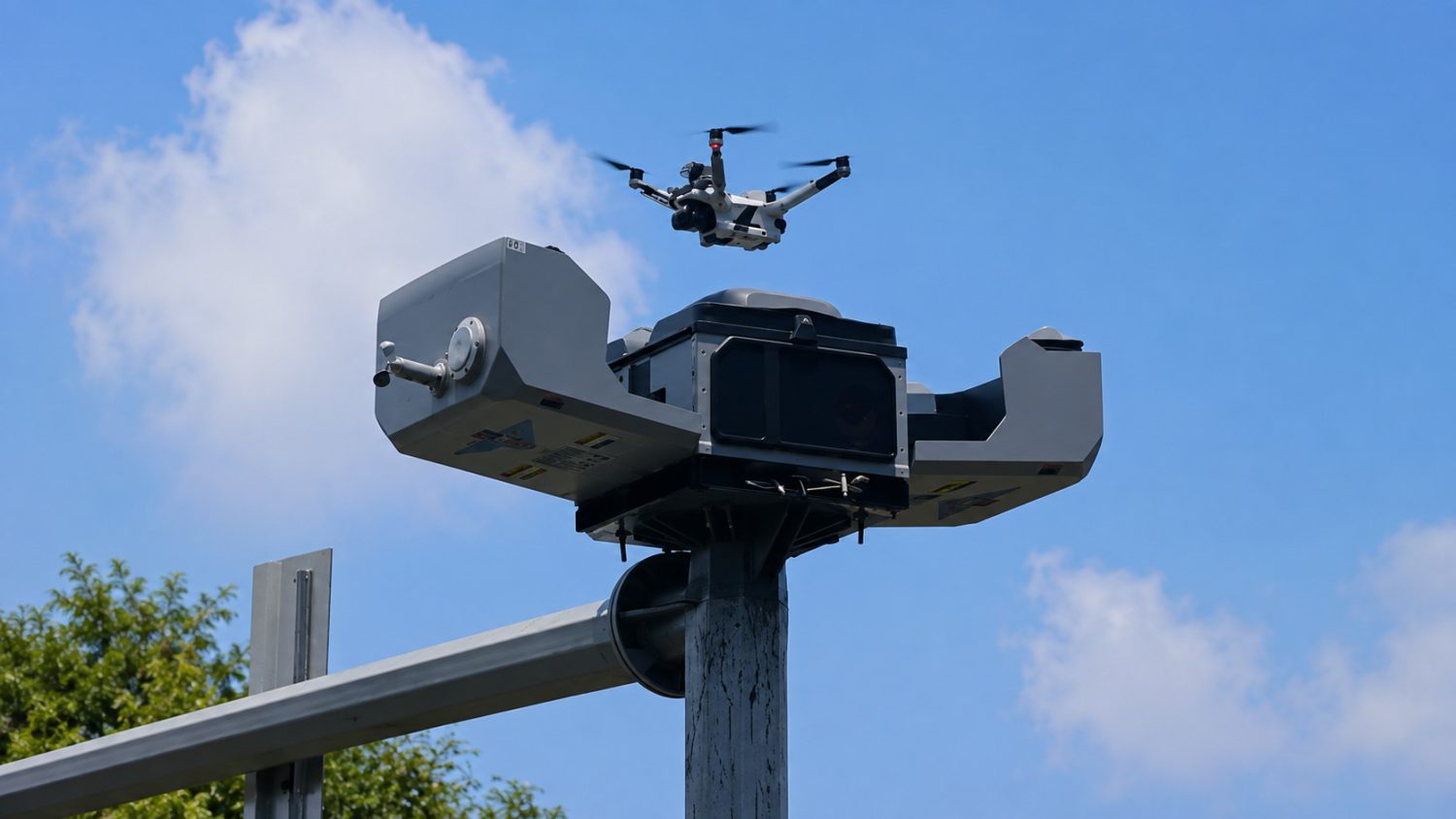
A 911 call drops. Before any officer keys the ignition, a drone on a nearby rooftop is already airborne, streaming live video to a command center. No manual setup. No officer at the launch point. Just automated infrastructure doing its job while units are still en route. That’s not a speculative concept running somewhere exotic — that’s how policing works right now in multiple cities across the U.S., UK, UAE, and China — and your city may already be next. The same impulse that produces automated drone docks also produces a surveillance app built to monitor political dissidents, and the infrastructure logic connecting them is worth understanding.
How Drone-in-a-Box Actually Works
A weather-protected rooftop dock replaces the officer as the launch point — and that operational shift changes everything about this conversation.
A Drone as First Responder (DFR) system is exactly what the name suggests: a weather-sealed dock, usually rooftop-mounted, housing a drone that auto-launches when a qualifying 911 call triggers it. The drone streams live footage to dispatch while officers are still driving. Yonkers claims its dock-based drones can reach anywhere in the city in under three minutes. BRINC markets a sub-70-second response target for 911 calls. Both figures are deployment-specific, not universal benchmarks — but the direction they point is consistent.
Traditional police drone use required an officer to physically retrieve, set up, and fly on-site. DFR removes the need for anyone at the physical launch point. London’s Metropolitan Police stores drones in rooftop containers that activate remotely, streaming live video to officers and control centers before ground units arrive. MITRE characterizes these systems as providing “real-time situational awareness to first responders” — framing that supporters lean on heavily and critics find dangerously incomplete.
From Emergency Tool to Surveillance Layer
Wuhan’s 146 automated drone docks serve traffic enforcement, environmental inspections, and municipal management across a megacity — a scale that reframes what “emergency response infrastructure” actually means.
The Wuhan “Urban Smart Eye” network is the figure that sharpens the debate. One hundred and forty-six automated drone docks, deployed across a megacity for multi-department use spanning:
- emergency response
- traffic management
- environmental inspection
Chinese cities have also rolled out “drone-on-a-pole” systems for traffic monitoring and enforcement. The line between first-responder tool and always-on urban surveillance isn’t blurry there — in meaningful operational terms, it has already moved. Civil liberties organizations and privacy researchers warn Western deployments risk following the same trajectory if oversight frameworks don’t develop alongside the technology.
The operational complexity deepens when DFR systems connect to adjacent infrastructure. These systems don’t operate in isolation — they plug into dispatch software, license-plate readers, AI cameras, and command-center integrations. Flock Safety’s fixed ALPR cameras capture publicly visible vehicles, and the company states its systems include customer-controlled retention settings and audit trails. Critics counter that once these nodes connect — drones, cameras, ALPRs, dispatch AI — each new dock expands the monitoring network’s reach and persistence, much like how secretly tracking users through seemingly routine apps revealed how quietly pervasive data collection can become. Think of how Ring doorbell cameras quietly became a neighborhood surveillance grid before most residents realized it had happened. Same network dynamic, much faster aircraft.
That’s precisely why DeFlock exists: a crowdsourced, open-source map letting residents identify surveillance infrastructure in their own neighborhoods.
The infrastructure is already there. The policy debate is running behind it.
The real question isn’t whether cities will deploy these systems — London, Yonkers, Wuhan, and others have already answered that. It’s whether procurement rules, data retention standards, and genuine public oversight can keep them bounded as emergency tools before they quietly become the default urban sensor layer nobody actually voted for. That window is closing fast.