




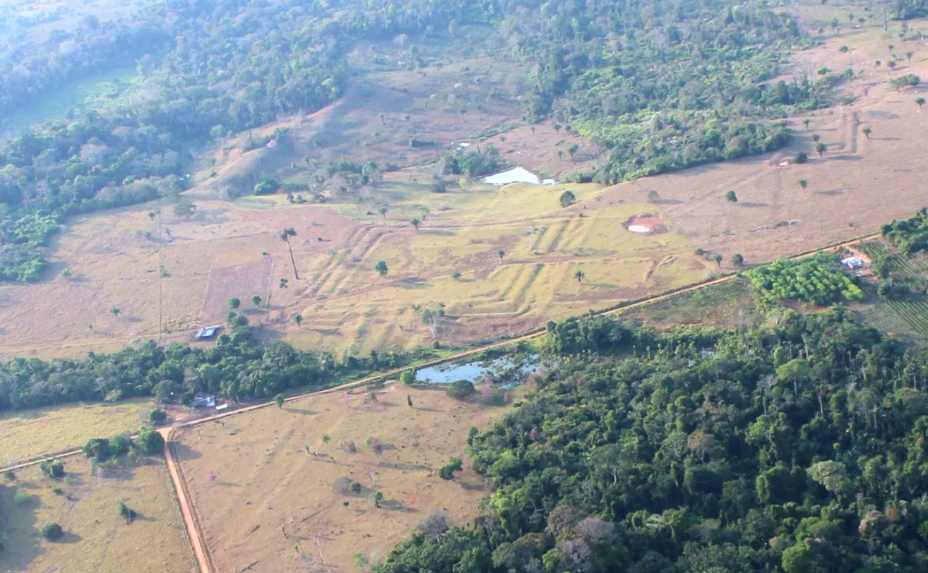
A research team led by Martti Pärssinen fired airborne LiDAR across 4,500 square kilometers of Acre, Brazil, and found 396 previously unknown earthworks lurking beneath the trees. Circles, squares, octagons — some hundreds of meters wide — carved from deep ditches with raised earthen banks. Scale that discovery across the full Aquiry cultural region of 183,000 square kilometers, and the estimated total hits 20,000 to 30,000 structures. It turns out to be a story that scholarship is still catching up to.
The Aquiry tradition flourished from roughly 600 BCE to 850 CE, peaking between AD 100 and 300 with an estimated 1.25 to 3 million inhabitants. Researchers describe the findings as having “completely transformed my understanding” of Amazonian history, according to ScienceAlert.
These weren’t forts or farmsteads. Based on indigenous oral traditions and site layouts, the earthworks functioned as ceremonial and political hubs — spaces for:
- ritual dances
- feasting
- ball games
- trade
- governance
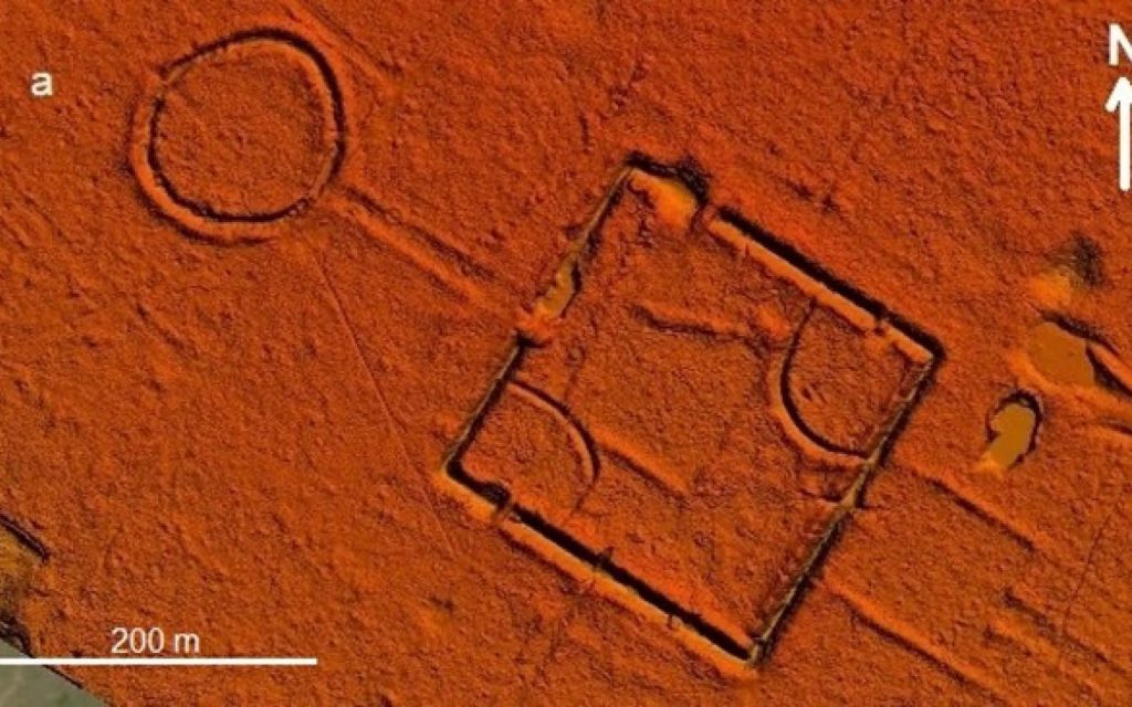
The Aquiry cultivated maize, cassava, and squash while managing surrounding forest through planned burning and tree cultivation. Straight roads and causeways connected major centers into regional networks — think less isolated jungle village, more a pre-Columbian metro grid with purpose-built gathering spaces at every node.
The Map Is Still Being Drawn
Only a fraction of the Amazon has been scanned, and statistical models predict thousands more earthworks remain buried under canopy across the continent.
A separate model published in Science estimates 10,000 to 24,000 additional earthworks remain undiscovered across Amazonia. Ecuador’s Upano Valley has already yielded 6,000 earthen platforms across 300 square kilometers, and Bolivia’s Llanos de Moxos echoes the same pattern — making this not a regional anomaly but a continental one.
Older scholarship assumed Amazonia’s poor soils kept populations small and mobile. That framework has been crumbling for years: first with the discovery of terra preta — dark, intentionally enriched soils — then raised fields and fish weirs, and now this. Broader estimates now suggest 5 to 8 million people lived across the Amazon basin around 1500 CE, far exceeding older figures of roughly 2 million, according to historical syntheses cited by National Geographic. Some researchers caution these numbers depend heavily on modeling assumptions, and dense settlement zones likely coexisted alongside large uninhabited tracts.
What’s emerging beneath the canopy isn’t a single lost city. It’s evidence that the Amazon was an engineered, densely populated cultural landscape for millennia — and that carries real consequences for conservation policy, indigenous land rights, and every climate model built on the assumption that nobody was home.