Your license plate gets photographed countless times during routine drives, creating a detailed log of everywhere you’ve been. That invisible tracking network just became visible through DeFlock, an open-source project that crowdsources the locations of automated license plate readers (ALPRs) across the globe.
Turning Surveillance Into Navigation
DeFlock transforms hidden camera networks into something you can actually navigate around.
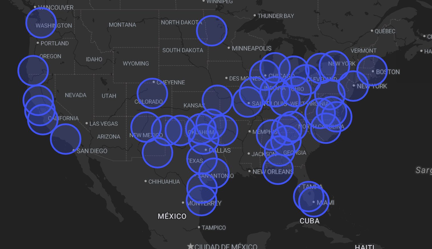
DeFlock works like Waze for privacy-conscious users. Built on OpenStreetMap, the app displays nearly 12,000 ALPR cameras worldwide, showing not just where they’re installed but which direction they face and who operates them. Users can report new devices they spot, building a community-driven database of surveillance infrastructure that law enforcement and companies prefer to keep opaque.
The DeFlock Maps companion site goes beyond mere dots on a screen—it generates “privacy-optimized routes” across the United States. Think of it as GPS routing that treats data collection points like traffic jams to avoid. According to 404 Media, what started as a few dozen cameras in Huntsville has exploded into thousands of mapped devices in cities nationwide, with contributions accelerating as awareness spreads.
Making the Invisible Visible
Most drivers have no idea they’re being tracked by an expanding network of AI-powered cameras.
Flock Safety and similar vendors have deployed tens of thousands of cameras that log not just license plates but vehicle makes, colors, and even bumper stickers. These systems create movement profiles that can be shared between police departments and private entities with minimal oversight.
DeFlock’s mission statement promises to “shine a light on widespread ALPR use” and “empower the public to take action.” Unlike typical navigation apps that monetize your location data, DeFlock runs without tracking users, analytics, or ads—practicing the privacy principles it preaches.
Routes Around the Panopticon
When you can see exactly where surveillance cameras cluster, route planning becomes a conscious choice about data exposure.
The practical impact hits differently than abstract privacy debates. Criminal Legal News describes it as giving citizens “a rare glimpse into a surveillance network often shrouded in secrecy.” Camera clusters often appear at neighborhood entry points or along certain corridors, making the invisible architecture of surveillance suddenly navigable.
Sure, the crowdsourced data remains incomplete, and determined trackers have other tools. But DeFlock represents something bigger: ordinary people using open mapping to audit the infrastructure watching them, turning surveillance visibility from a one-way street into something approaching democratic oversight.